 Katalog Metadata Geospasial Provinsi Kalimantan Timur
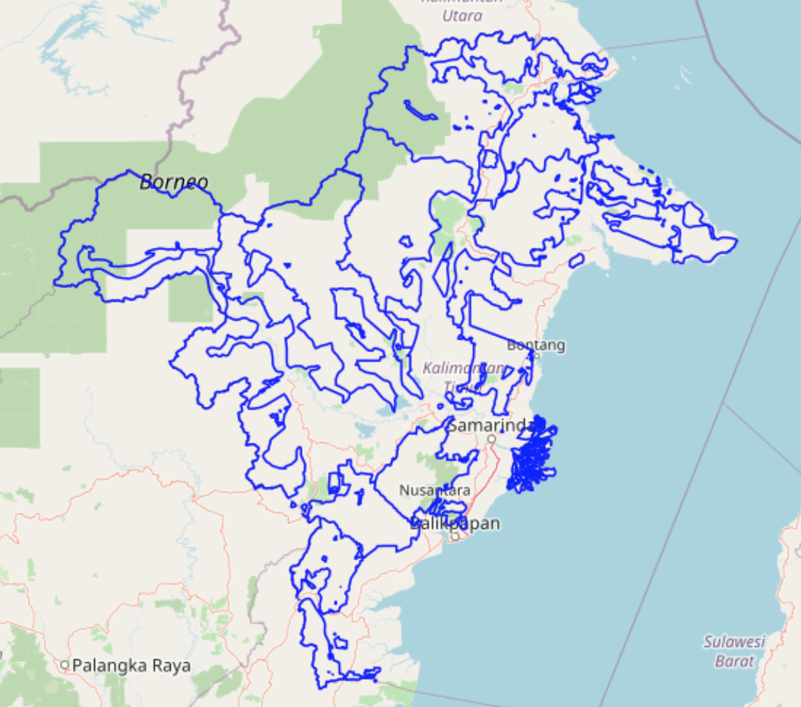
kph_kaltim_line
Simple
- Alternate title
- geonode:kph_kaltim_line
- Date (Publication)
- 2024-09-13T00:44:05
- Presentation form
- Digital map
- Purpose
- None
- Status
- Completed
(0541) 736003
- Name
- ESRI Shapefile
- Version
- 1.0
- Place
-
- Global
- Asia
- East Asia
- South Asia
- Southeast Asia
- Indonesia
- Malaysia
- Pacific
- Kiribati
- Use constraints
- License
- Other constraints
- Not Specified: The original author did not specify a license.
- Other constraints
- None
- Metadata language
- eng
- Character set
- UTF8
))
- Supplemental Information
- No information provided
- Reference system identifier
- EPSG / 4326 / 6.11
Spatial representation info
- OnLine resource
-
Online link to the 'kph_kaltim_line' description on GeoNode
(
WWW:LINK-1.0-http--link
)
Online link to the 'kph_kaltim_line' description on GeoNode
- OnLine resource
-
kph_kaltim_line.jpg
(
WWW:DOWNLOAD-1.0-http--download
)
kph_kaltim_line (JPEG Format)
- OnLine resource
-
kph_kaltim_line.png
(
WWW:DOWNLOAD-1.0-http--download
)
kph_kaltim_line (PNG Format)
- OnLine resource
-
kph_kaltim_line.gml
(
WWW:DOWNLOAD-1.0-http--download
)
kph_kaltim_line (GML 3.1.1 Format)
- OnLine resource
-
kph_kaltim_line.csv
(
WWW:DOWNLOAD-1.0-http--download
)
kph_kaltim_line (CSV Format)
- OnLine resource
-
kph_kaltim_line.excel
(
WWW:DOWNLOAD-1.0-http--download
)
kph_kaltim_line (Excel Format)
- OnLine resource
-
kph_kaltim_line.json
(
WWW:DOWNLOAD-1.0-http--download
)
kph_kaltim_line (GeoJSON Format)
- OnLine resource
-
kph_kaltim_line.zip
(
WWW:DOWNLOAD-1.0-http--download
)
kph_kaltim_line (Original Dataset Format)
- OnLine resource
-
kph_kaltim_line.pdf
(
WWW:DOWNLOAD-1.0-http--download
)
kph_kaltim_line (PDF Format)
- OnLine resource
-
kph_kaltim_line.zip
(
WWW:DOWNLOAD-1.0-http--download
)
kph_kaltim_line (Zipped Shapefile Format)
- OnLine resource
-
kph_kaltim_line.gml
(
WWW:DOWNLOAD-1.0-http--download
)
kph_kaltim_line (GML 2.0 Format)
- OnLine resource
-
kph_kaltim_line.png
(
WWW:DOWNLOAD-1.0-http--download
)
kph_kaltim_line (Legend Format)
- OnLine resource
-
geonode:kph_kaltim_line
(
OGC:WMS
)
geonode Service - Provides Layer: kph_kaltim_line
- OnLine resource
-
geonode:kph_kaltim_line
(
OGC:WFS
)
geonode Service - Provides Layer: kph_kaltim_line
- Hierarchy level
- Dataset
- Statement
- None
- Included with dataset
- Feature catalogue citation
- File identifier
- 38b326df-688c-4096-a4e1-38a795b7843a XML
- Metadata language
- eng
- Character set
- UTF8
- Hierarchy level
- Dataset
- Date stamp
- 2024-10-09T00:58:43
- Metadata standard name
- ISO 19115:2003 - Geographic information - Metadata
- Metadata standard version
- ISO 19115:2003
(0541) 736003
(0541) 736003
Overviews
Spatial extent
Provided by
